So now let’s see what happens if I start a new topic ( ).
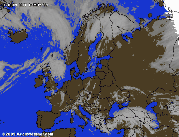
The map that I have as wallpaper, Western Europe/Germany, has blurred political boundaries and coastlines. It looks the same as when a picture has been “enhanced” to get more contrast. Adjacent to the black lines you see a whitish shade plus some computerish speckles. Would it be possible to show the regular, original maps, without artificially sharpened boundaries?
I knew you could do it. Don’t you feel proud of yourself now? :iconbiggrin:
No.
WW has no option to enhance an image prior to it being displayed. It merely passes the image you select to Windows.
I’m assuming we are still talking about the http://image.de.weather.com/web/maps/sa … 20x486.jpg image from earlier. If you change it’s setting to Center verses Stretch it will reduce the stretch effects you are seeing. 720x486 appears to be the largest size image weather.com has for your region which is better than Accuweather’s 640x480 images.
We are. Check that file! Zoom in till The Netherlands fill your screen. The sea close to the land is white! Even in centred mode. It is not the stretching that makes the speckles and “enhancement”.
That one is different, but not better. It has artificial shadowing instead of enhancement. And the resolution of the political contours seems somewhat poorer. I’ll stay with the former map.
question
Is it possible to plot precipitation maps as wallpaper? The german site has some radar images, which may be enough for a dutchman like me … Rain affects my decisions more than just “any” type of clouds.
Are you kidding!! I get distortion of the borders and etc when I expand the whole 720x488 image to my 1280x1024 screen which is approximately 2x, and you wonder how it happens when you zoom in to just The Netherlands!!!
Search for local weather sites for Utrecht, Netherlands (NLXX0018) and see if you see anything bigger or more refined to the The Netherlands borders. Try local TV sites, local newspapers, local websites. I used Google but didn’t find anything much better for you.
I would think any image could be used as wallpaper, the question is can you find any precipitation maps. WW’s current forecast window should help you plan your day using either the Hour or Day tabs at the bottom.
Are you kidding!! I get distortion of the borders and etc when I expand
the whole 720x488 image to my 1280x1024 screen which is
approximately 2x, and you wonder how it happens when you zoom in to
just The Netherlands!!!
Sorry Ed, but even without zooming in you can see that the original picture has been tempered with. In PaintShopPro or similar program you can zoom in by showing the individual pixels as rectangular tiles. No distortion in the zooming process. But awful result on the screen. Conclusion: the picture files that are downloaded by WW are not the original pictures!
Search for local weather sites for Utrecht, Netherlands (NLXX0018) and
see if you see anything bigger or more refined to the The Netherlands
borders. Try local TV sites, local newspapers, local websites. I used
Google but didn’t find anything much better for you.
[…]
I would think any image could be used as wallpaper, the question is can
you find any precipitation maps.
I can: Ed, can you please make WW have a regular peek at http://www.wetteronline.de/radar/euroddlnw.htm
and get the fresh rain radar every 15 minutes? I don’t know how to include pictures in the messages to this forum, but you’ll see what I mean. They have rain radar images for other regions too if you browse through that site. As you can see we have summer over here (no rain)!
A holiday?!! How nice, have fun.
Arrow Rock festival: Deep Purple, DIO, Status Quo, Roger Waters (3 hours!), etc… Old names and only faces with ripples (hence the local name for the festival “Rock and Rollator”), but a Great weekend!
Well Arjan you’re in luck. The animated map you linked to is an animated GIF which can be added to WW.
The approach I use is to open MapsHistory.ww in Notepad and add the maps I prefer to it in the format:
“[label] type”,“link”
So for your maps I would add:
"[Arjan's] WeerOnline 3 Stunden","http://www.wetteronline.de/daten/radar/ddlnw/vie.gif?LANG=de"
"[Arjan's] WeerOnline Loop 90 Minuten","http://www.wetteronline.de/daten/radar/ddlnw/std.gif?LANG=de"
Note the above code is TWO lines not four. Forum wrapping may make them appear as four.
The question is will the links refer to current images or will it be stuck at one time period but I suspect they will always show the most current image.
You can add the same line of code to the Maps.ww file but WW updates replace it so you would have to manually remake the change after each ww update. The history file is more stable and is available when you RIGHT click the tray icon. :icon_smile:
(There are three means of animated images; animated GIFs, images animated using JScript, and images animated using Java. The latter two can’t be animated within WW and in some cases can’t even be added to WW.)
I think you mean the pictures the websites WW uses are not the original pictures. WW doesn’t change them, it simply accesses them. But we may be simply talking of semantics.
Glad you hear you had an enjoyable weekend. :icon_smile:
Thanks, I’ll try this at home (where my pc listens better to what I say than here at the office). I remember that you cannot set animations as wallpaper, so I expect your suggestion to lead to an additional feature on the “active city” Utrecht forecast sheet instead. Am I right? Or can you/I set the animated rainfall as wallpaper?
Regards,
Arjan
ps.
I think you mean the pictures the websites Weather Watcher uses are
not the original pictures. Weather Watcher doesn’t change them, it
simply accesses them. But we may be simply talking of semantics.
I think we share points of view on this. Remains the quest for the original, better pictures. Although I wouldn’t need them anymore if I will succeed in installing the german rain radar…
You can add the same line of code to the Maps.ww file but Weather
Watcher updates replace it so you would have to manually remake the
change after each Weather Watcher update.
Not if you make this suggestion a default-selection in your new releases!
Don’t you think other users will consider the bundle of choices you can distillate from that site a valuable feature of WW? They offer more than just rainfall in Utrecht!
Wallpaper animation is a function of Windows not WW. And supposedly can be done using Active Desktop. I have not tried this so I don’t know if this is true for all versions of Windows or how to set it up.
Well Arjan you’re in luck. The animated map you linked to is an
animated GIF which can be added to Weather Watcher.
Back home now. It works: I now have a map of my country without rain, which is correct: it’s deep blue out there. We have summer.
BUT: I ticked “Stretch maps to fit Map Viewer window”. Somehow this does not apply to animated GIFs… No matter how strong I pull the edges of the window: only the viewer window itself is stretched, not its contents.
Can you help here?
The question is will the links refer to current images or will it be stuck
at one time period but I suspect they will always show the most current > image.
Manually pressing “refresh” on the Map Viewer just worked. A relief. Now I am waiting for the next one to be refreshed automatically. You’ll hear from me.
Now I am waiting for the next one to be refreshed automatically.
You’ll hear from me.
Hmmmmmm. No auto-update, though it was set to 5 minutes to be on the safe side. I left the wallpaper update to 30 minutes, but the Map Viewer is no wallpaper, so that should not interfere. After pressing “update” on the Map Viewer I get a fresh new GIF animation with more recent data.
I don’t know what Wetter’s update of the image’s frequency is but it has to
be taken into account also.
That’s the one thing where some improvement must be gainable:
WetterOnline gives updates every 15 minutes. This is confirmed by the new GIF that I get when I press “Refresh” in the MapViewer. Therefore I hope that this refresh step can still be expected to work automatically from within WW via one of the refresh times that I had set. I think that the non-refreshing behaviour of the map at present is a “sub-optimal” functioning of WW. Can you come back on this please?
Wetter creates an image with a fixed name and in a fixed location and thus with a fixed URL. It updates this image periodically.
WW retrieves images from the web periodically, whether maps or weather icons.
If the WW update frequency is less than the Wetter frequency then WW will always load a fresh image. So, for example, if Wetter updates the image every 16 minutes, and WW updates every 30 minutes, Ww will retrieve a new image each time it updates. If ww is set to update every 10 minutes it will reload the same image every other update. (Thus nothing is to be gained from setting ww to update every minute for example.)
Maps used as wallpaper should be refreshed to the current Wetter image when WW updates. How frequently the Map Viewer updates it’s view is another issue. I don’t think the Map Viewer has an auto refresh option. So even if WW retrieves a newer image the Map Viewer will continue to display the old one until such time as the Refresh button is pressed.
If you want a separate window for the map image that refreshes automatically it can probably be created as a separate little html file with a Refresh tag outside the realm of ww that you can open in a separate browser window.
If you want a separate window for the map image that refreshes
automatically it can probably be created as a separate little html file
with a Refresh tag outside the realm of Weather Watcher that you can
open in a separate browser window.
You’re probably right. But (-oh, no!-, okay, I have 2 kids myself, so know how this “but” sounds): WW needs just that single additional option to make WW the complete local weather tool on my screen. And the refresh-button has already been implemented on the Map Viewer!
If you open the Wetter image in PaintShopPro or similar program does it auto-refresh? If you open the URL of the image in IE does it auto-refresh? If you open the Wetter webpage that displays the image does it auto-refresh?
Do you really keep the Map Viewer and WW windows open all the time? Are they always visible?
Other than that it seems like a reasonable idea. When WW refreshes the image to check to see if Map Viewer is running and to auto refresh it also.
If you open the Wetter image in PaintShopPro or similar program does
it auto-refresh? If you open the URL of the image in IE does it auto-
refresh? If you open the Wetter webpage that displays the image does
it auto-refresh?
No - no - no - no
Do you really keep the Map Viewer and Weather Watcher windows
open all the time? Are they always visible?
Yes - Yes - Yes - Yes (surprised??). We have so much rain that it pays off to have it readily available.
Other than that it seems like a reasonable idea. When Weather Watcher
refreshes the image to check to see if Map Viewer is running and to
auto refresh it also.
When you’re in Utrecht, call for a beer! Ever since you people from a different continent have decided that Westvleteren 12 is the Best Beer in the Wordt, I cannot serve it to you anymore (out of stoch for the coming 24 months), but I can serve you a Rochefort 10, which is just as good. Belgian, by the way, not dutch. Both of them. But we Dutchmen are proud when we can sell or buy (or drink) them… Once a trader, always a trader!